 |
|
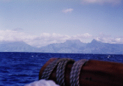
Spring 1995: Na 'Ohana Holo Moana Photo right: Landfall Tahiti, March 3, 1992 Feb. 27, 1995--16th day of the voyage, 5 a.m.
At 3 p.m (HST) , Feb. 26: Hokule'a: 4 degrees 13'S; 148 degrees 23' W Hokule'a is about 16 miles south and 21 miles east of Hawai'iloa, about 10 miles E; Hawai'iloa is 10 miles W of the reference course. The canoes are about 1500 miles from Hawai'i. Pape'ete, Tahiti, the primary destination, lies 800 miles to the south. Report from Feb. 25, Saturday a.m. Nights have been remarkably clear. The navigators are able to use all the stars and planets in their navigation. Wind is coming from E by S, swells from the E. Heading: Haka Malanai (S by E) to gain easting; later the pl an is to head Hema (S). No dolphin visitations last night: Birds such as the 'a (booby) and 'ewa'ewa (sooty tern) attempt to land on the rigging. The crew chases the birds off to prevent droppings on the canoe. News from the Big Island: The canoe E'ala will arrive on a barge at Kawaihae on Monday to begin a Polynesian Voyaging Society Exploration Learning Program on the Kona Coast. Students from Hilo, Konawaena, Ka'u, Hale o Ho'oponopono, and Na Pua Noeau will p articipate. Angel Pilago is the PVS coordinator in Kona; Kahualaulani Mick will serve as head trainer. Makali'i, the 52 foot voyaging canoe built in Waimea, left Mahukona 3 a.m. Sunday Morning for Hilo, from where the canoe will depart for Tahiti. Shorty Bertelmann is the navigator. Crew members (10) are: Shorty Bertelmann, navigator; Clay Bertelmann, capt ain; Tiger Espere; Billy Richards; Maulili Dixon; Chad Paishon; Mike Manu; Darrell Lapulapu; John Shore; Ernest Reyes. Feb. 28--17th day of the voyage, 6 a.m. Latest ARGOS fixes from Bernie Kilonsky at UH Manoa (3 a.m. on Feb. 28): Hokule'a: 8 degrees S, 148 14'W Hokule'a is 75 miles due south of Hawai'iloa. It has sailed about 45 miles since the last fix at 6 p.m. last night. Average speed: 5 knots. At 6 p.m, Feb. 27, the canoes were at: Hokule'a: 7 degrees 15' S, 147 degrees, 51 minutes W Holding courses of Haka Malanai (S by E), they are both east of the reference course and in good position for the final run to Tahiti. Hokule'a was averaging 6.6 knots over the 24 periods from 6 p.m. Feb. 26 to 6 p.m. Feb. 27; at 6 p.m., Feb. 27, it was 4 50 miles due north of the giant atoll of Rangiroa in the Tuamotu archipelago. At the current speed, the canoe could make landfall there in 3-4 days (Mar. 2 or 3). Tahiti lies another 150-200 miles beyond the Tuamotus. At 6 p.m., Feb. 27, Hawai'iloa was ap prox. 50 miles NW of Hokule'a averaging 6 knots. The success of this voyage depends not on staying on the reference course, but on making landfall somewhere in a 400-mile wide target screen which stretches from Manihi atoll in the Tuamotus (14 degrees 25' S, 145 degrees 57' W) to Maupiti (17 degrees 27' S, 152 degrees 15'W), one of the westernmost islands in Tahiti Nui (Society Islands). Once an island is identified, the navigators will set a course for Pape'ete, Tahiti. They have memorized the positions of dozens of islands in the Tuamotus and Tahitit Nui and the directions in which their destination of Tahiti lies from these islands. On the morning of February 27, Kimo Lyman on board Hawai'iloa reported east winds of 10-15 knots, a small E swell, and an even smaller SE swell. The navigators' estimated position was 4 degrees S, 59 miles east of the reference course. At were actually ab out 100 miles farther south, and about 10 miles east of their reference course. Weather Analysis (Dan Schowerer for 2/26): Surface charts show east winds at 10-15 knots. Upper level winds are west at 10-20 knots. The canoes are still in an area of subsidence, which should keep skies fair and for the most part clear. A trough located at (155W, 140W, 15S, 30S) is proudcing rain south of the canoes. The satellite photo shows low clouds moving with the wind to the east, with clouds at 160W, 150 W, between 6S and 10S. The green and blue on the IR image indicates rain in the area. As the c anoes sail toward the 5 degree line, they will get closer to the rain. The winds should continue east at 10-15 knots. March 1--18th day of the voyage, 6 a.m. Latest ARGOS fixes: Hokule'a (12 noon, Feb. 28): 9 degrees S, 148 degrees 12'W The canoes are travelling south at about 1 degrees (60 miles) every 12 hours. By 12 noon today, Hokule'a should be around 11 degrees S, Hawai'iloa about 10 degrees South. The Marquesas Islands lie about 350 miles to the east. Report for Feb. 28, a.m.: Scott reported that the crew had just pulled in a 130 lb. marlin; then he reported it was a 200 lb. marlin. Dennis: "The fish seem to grow in size out there after they're caught!" Scott: "No, really. It's twice as big as Bruce (B lankenfeld, one of the navigator), so it's at least 200 pounds!" The marlin was cut in half and half of it was floated back to the escort boat Kamahele. Hawai'iloa's fish count: 15 total (4 mahimahi, 4 aku, 4 spearfish, 2, 1 marlin). Hokule'a's fish count: 28 (11 mahimahi, 9 ono, 7 aku, 1 120 lb. ahi). Scott: "We are c atching one fish a day and pulling in the lines." Dennis: "They're catching more on Hokule'a." Scott: "They must have bigger eaters on their canoe." Request from Tom Chun's Kamehameha Schools Science Class: Save rainwater for chemical analysis. (Mike Tongg: "We have some empty mayonnaise jars; we'll wash them out and bring back some rainwater." Tom: "Okay, if we find mayonnaise oil in the analysis, we 'll know where it came from." How do you predict weather at sea? Nainoa Thompson explains you need to scan the horizon as far as you can see. You look at the wind speed and direction, the types of clouds and their shapes, and the size and direction of the swells. When will the canoes start looking for signs of land, such as birds? The crew was looking for birds today because they estimated they were near the latitude of Caroline Island (10 degrees S, 150 degrees 15' W), and the island was about 120 miles to the we st. Weather Analysis: The satellite image showed clearing in the area of the canoe. [The canoe reported a bright, sunny day; nighttime clouds melted in the morning.] The surface chart showed east winds at 10 knots. Forecast: Look for winds to continue out of the east, and light rain from scattered clouds. (DS, 2/28) March 2--19th day of the voyage, 4:30 a.m. HST Yesterday morning at 8 a.m. the canoes were at: Hokule'a: 11 degrees 16' S; 147 degrees 54' W The voyaging canoe Makali'i left Hilo on Feb. 28. On the morning of Mar. 1, it was SE of Hilo at 19 degrees 8'N, 154 degrees 06'W. Last night at 7 p.m., Hokule'a was at 12 degrees, 27' N, 147 degrees 39' W. It continued to head south at a little over 1 degree, or 60 miles per 12 hours. This morning the canoe would be about 13 degrees 30' N, about 150 miles north of and a day's sail f rom the giant atoll of Rangiroa in the Tuamotus. They could sight land tomorrow morning. Atolls, on which the highest feature is a palm tree, can be sighted from 7-10 miles out from the mast of a canoe. Formula for line of sight: The square root of the he ight of the observer (Feet above sea level) + the square root of the height of the object observed (Feet above sea level) x 1.3 nautical miles or 1.5 statute miles = miles away an object can be seen. Mar. 1, a.m. report: The seas were getting lumpier (6-8 ft.) and the wind picked up at bit to 12-18 knots, still easterly. The wind started to get strong around sunset and moderated at about 10 p.m. The canoes are sailing at 5-6 knots. Hawai'iloa is pumpi ng about 3-5 gallons of water out every 20-30 minutes from its open hulls--not a major problem, but a lot of work for the crew. Fishing continues to be great: Hawai'iloa caught 3 small ahi just before breakfast; Hokule'a reported hooking 2 ono (20 and 30 pounds) and 1 ahi. Last night Chad Baybayan of Hawai'iloa said he and Bruce used Duhbe in the Big Dipper, and Holopuni (Kochab) and Pherkad in the Little Dipper as these stars crossed the meridian, to determine latitude and correct for any error in dead reckoning. He estima ted Hawai'iloa was at 10 degrees S and 84 miles E of the reference course. Joe of Peacesat: "Once you make landfall, will you recognize the island you found?" Nainoa: "I would recognize any of the Society Islands and the four western islands of the Tuamotus: Matahiva, Tikehau, Rangiroa, and Arutua. If the canoe arrived at one of the islands farther east, I wouldn't know which one since I've never been to those islands." "Have you sighted any birds yet?" Chad: "Not any land based birds. We sighted some tropic birds (koa'e) yesterday. We'll start looking for land birds in a day or two." [The canoes could make landfall Friday, Mar. 3.] The koa'e, or tropic bird, is noted for its long red or white tail feathers which appear like streamers behind the bird as it flies. The koa'e nests in the cliffs, such as those found in the Marquesas Islands and Hawai'i. It is capable of flying "for long periods without rest, alternating soaring glides with fluttering wingstrokes. They seldom rest on the water, but they can float buoyantly with their streamers cocked." Since they do not necessarily return to land each day, their presence is not an indica tion that land is near; and their flight at sunrise and sunset does not indicate the direction of land. "Christopher Columbus was ignorant of the biology of these birds. On September 17, 1492, at 36 degrees west in the mid Atlantic, he wrote in his diary that he saw a tropicbird and therefore must be near land because the species 'is not accustomed to sleep on the sea.' Columbus was nowhere near land." (Seabirds of Hawaii: Natural History and Conservation by Craig S. Harrison, "Tropicbirds," pp. 166-174.) March 3--20th day of the voyage, 3:45 a.m. HST At 7:30 p.m. last night the canoes were at: Hokule'a: 15 degrees S, 148 degrees 17'W Hokule'a is a couple miles west of the atoll of Tikehau. The crew should have sighted land yesterday afternoon. The canoe appears to be rounding the atoll and heading for Pape'ete, about 160 miles SSW. It should arrive there early Friday afternoon. This h as been the fastest passage for Hokule'a in its five voyages south; in the past the voyage has taken up to 32 days. Hawai'iloa is about 60 miles N by W of Hokule'a, on a course toward Mataiva, the westernmost of the Tuamotus. They may sight the island this morning at dawn. The day before yesterday, the crews began seeing land-based birds that fish at sea: noio (noddy terns) and manu o Ku (fairy terns), though not in piles fishing, but lone birds. Hawai'iloa reported a noio followed the canoe for 3-4 hours and landed on the canoe. Interview with Sesario Sewralur, son of Mau Piailug, the 14th of 16th children: Both are crewmembers on Hokule'a. According to Sesario, Mau is the youngest of the navigators on Satawal, Micronesia. Mau is over 70 years old. Sesario is studying long distan ce, non-instrument navigation on this voyage and hopes to carry on his father's tradition. Makali'i Report: At 7:23 a.m. March 2, Makali'i was at 18 degrees 2' N, 153 degrees 04'W, heading SE from Hilo at about 3.5 knots, about 150 miles out. March 5--22th day of the voyage, 7:20 HST Hokule'a and Hawai'iloa were towed into Pape'ete Harbor yesterday morning, March 4, at 9 a.m. for welcoming ceremonies on shore. The two canoes rendezvoused off of Pape'ete in the early morning before dawn; at dawn, they saw each other for the first time in over two weeks. Hokule'a made landfall on March 2, sighting the island of Tikehau at 3 p.m. After identifying the island and determining their position, the navigators Keahi Omai and Ka'au McKenney, who had both completed their first long voyages, turned over navigation to their apprentices Junior Coleman and Sesario Sewralur, who then guided the canoe to Pape'ete. Hawai'iloa made landfall in the South Pacific for the first time. Navigators Bruce Blankenfeld and Chad Baybayan, after picking up land-based fishing birds (Noio, or Noddy Terns, and Manu o Ku or Fairy Terns) on the afternoon of March 2, followed the bird s. At 2 a.m. in the morning, the crew sighted lights and from the isolation of the lights, guessed the island to be Mataiva, 30 miles west of Tikehau. In the light of dawn, the crew sighted and identified Mataiva, and continued on to Pape'ete. As the canoes were towed into Pape'ete Harbor, Hawai'iloa crew member Brad Cooper talked with his Kamehameha Schools 7th grade students over the radio. What did he miss most? Things that were refrigerated. He looked forward to eating ice cream. What was his greatest fear during the voyage? Falling overboard and being lost as sea. Were they ever in danger of running out of food? No, because they caught so much fish [and because the voyage was so fast]. The crew ate only one-third of their food supply. What did he do on watch? Steer the course set by the navigators. Trim the sails. Pump the open hulls every half hour. Check the rigging for loose or frayed lines. Boil water to make cocoa or coffee for the next watch. Did they encounter any storms? Mainly squalls in the area of the doldrums. Did the canoe hold up well? One cracked decking plank. It needs more caulking. Otherwise, it did remarkably well. What was the first thing he planned to do on shore? Laundry. Would he go again on a long voyage? Given the opportunity, Yes! The crews will spend the next week on repairs and maintenance and working with the Tahitians, Cook Islanders, and Maoris, as they prepare their canoes for the upcoming voyages. The canoes will gather at Huahine on March 16 before crossing the channel to R a'iatea on March 17 or 18 for ceremonies at Taputapuatea. |
 The canoes continue their southerly course, making about 110-120 miles a day.